Miami Conservancy District monitors current river conditions, and provides information to the National Weather Service and the United States Geological Survey to create these graphs.
Click on any graph to view anticipated river levels as modeled by the Ohio River Forecast Center.
JUMP TO...
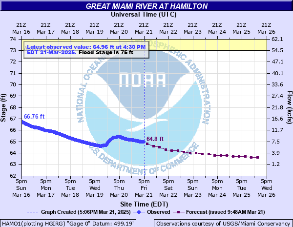
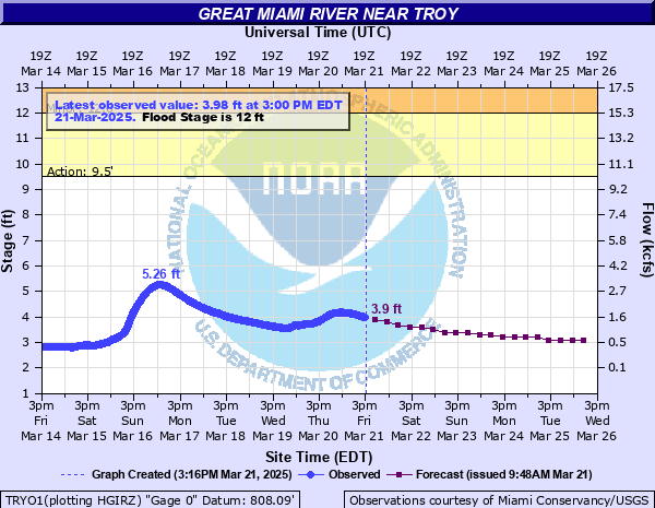
Great Miami River
Sidney | Piqua | Troy | Dayton | West Carrollton/Moraine | Miamisburg | Franklin | Middletown | Hamilton
Dams
Lockington Dam | Taylorsville Dam | Englewood Dam | Huffman Dam | Germantown Dam
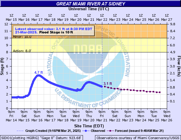
Sidney on the Great Miami River
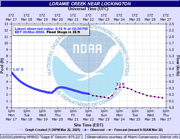
Lockington Flood Stages and Impacts
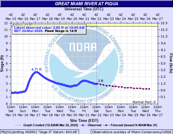
Piqua on the Great Miami River
Piqua Flood Stages and Impacts
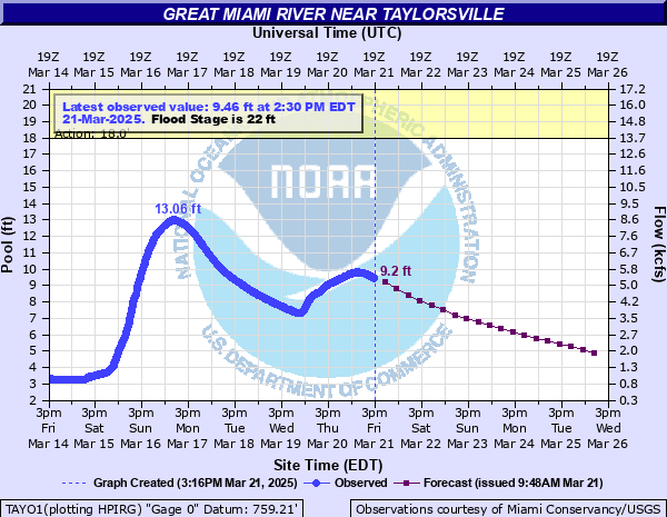
Taylorsville Dam on the Great Miami River
Taylorsville Dam Flood Stages and Impacts
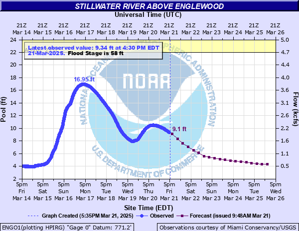
Englewood Dam on the Stillwater River
Englewood Dam Flood Stages and Impacts
Huffman Dam Flood Stages and Impacts
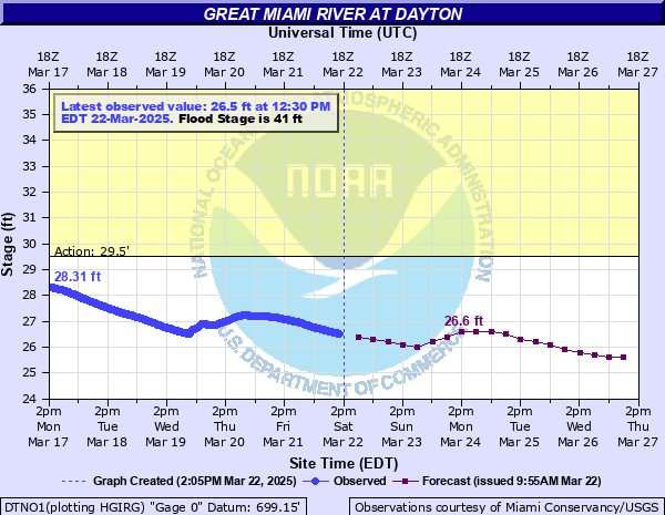
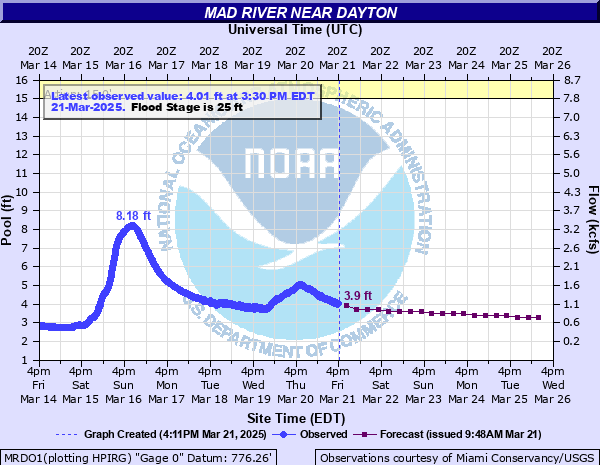
Dayton on the Great Miami River
Dayton Flood Stages and Impacts
West Carrollton/Moraine on the Great Miami
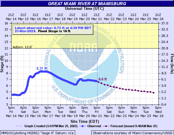
Miamisburg on the Great Miami River
Miamisburg Flood Stages and Impacts
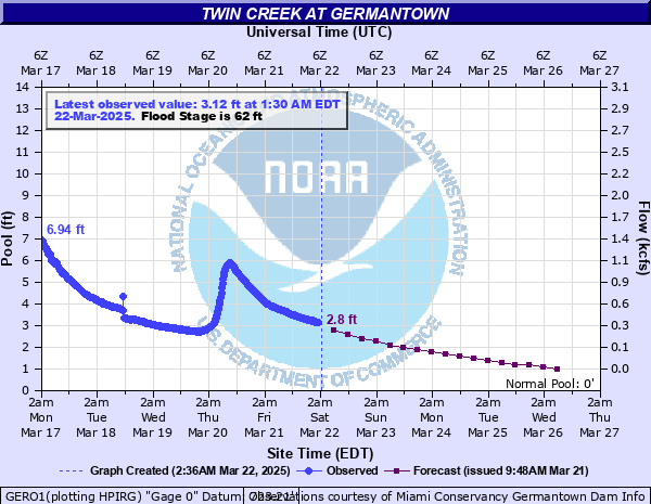
Germantown Dam Flood Stages and Impacts
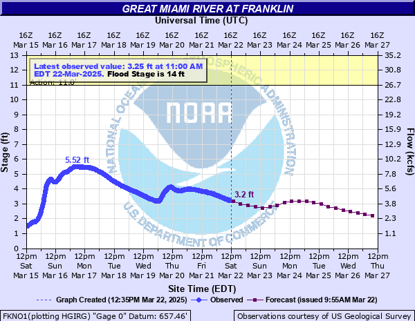
Franklin on the Great Miami River
Franklin Flood Stages and Impacts
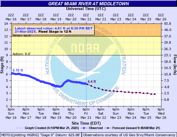
Middletown on the Great Miami River
Middletown Flood Stages and Impacts